 Yorimichi Games
How to play the World Countries Quiz
This is a geography quiz built around a real world map. There are three kinds of question. In Find on the map, a country’s name appears and you tap that country on the map. In Map → name, one country lights up in orange and you pick its name from four buttons. In Capitals, you choose the capital city of the country shown. You can play one type at a time or mix all three. It is a single-player game that runs in the browser, with nothing to install and no account to create.
You can work through one continent at a time or take on the whole world at once. When you choose a region, the map zooms to that part of the world and everything outside it turns gray, so you only have to think about the countries in play.
Find countries on the world map
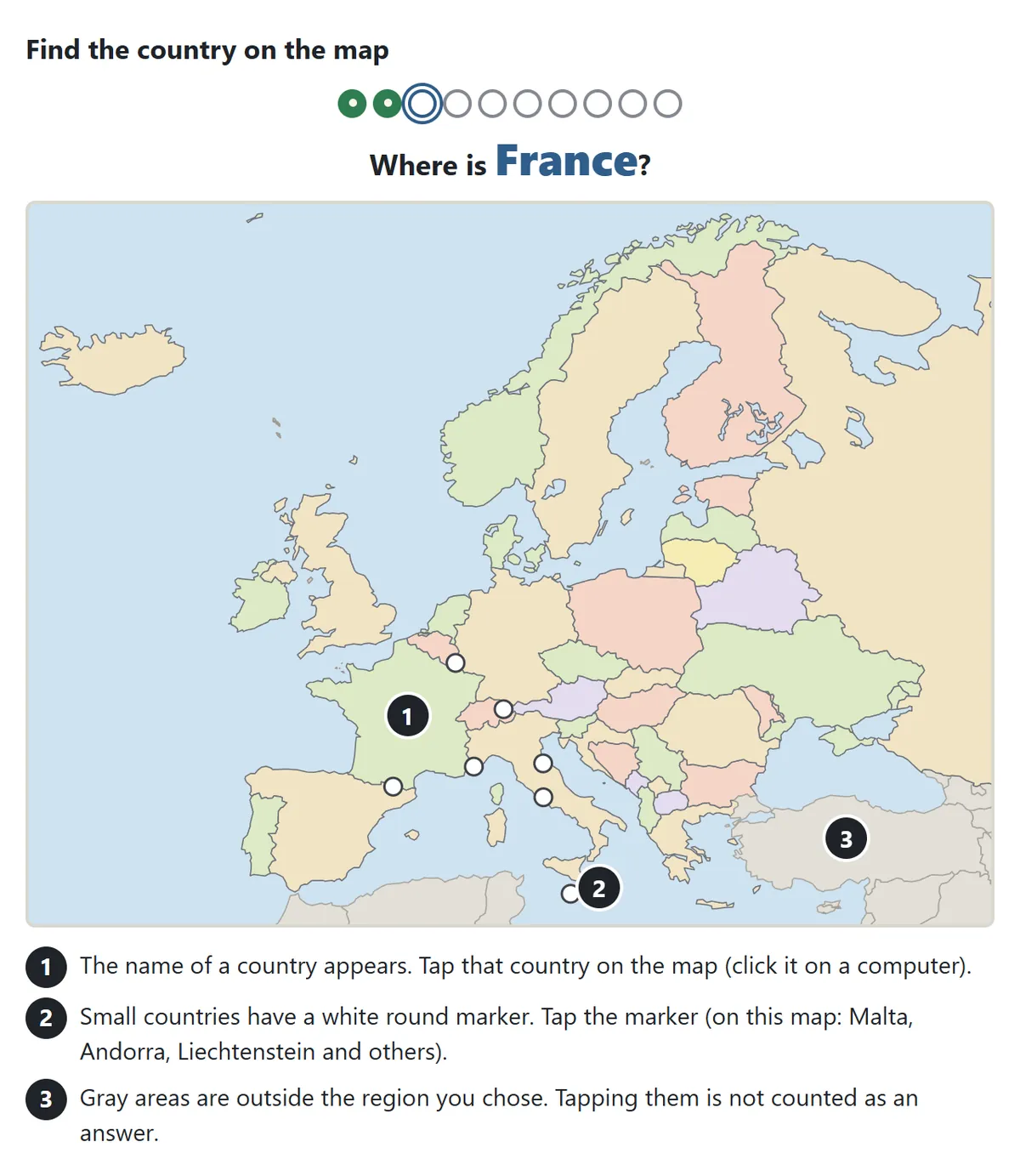
The name of a country appears above the map. Click it with the mouse or tap it with your finger. Some countries are far too small to hit on a world map – Vatican City, Monaco, Malta, and many island nations in the Caribbean and the Pacific – so they carry a white circle. Tap the circle instead of the land. Tapping the sea, a gray area or a striped area never counts as a wrong answer; the game simply tells you that the spot is not part of the quiz.
When you miss
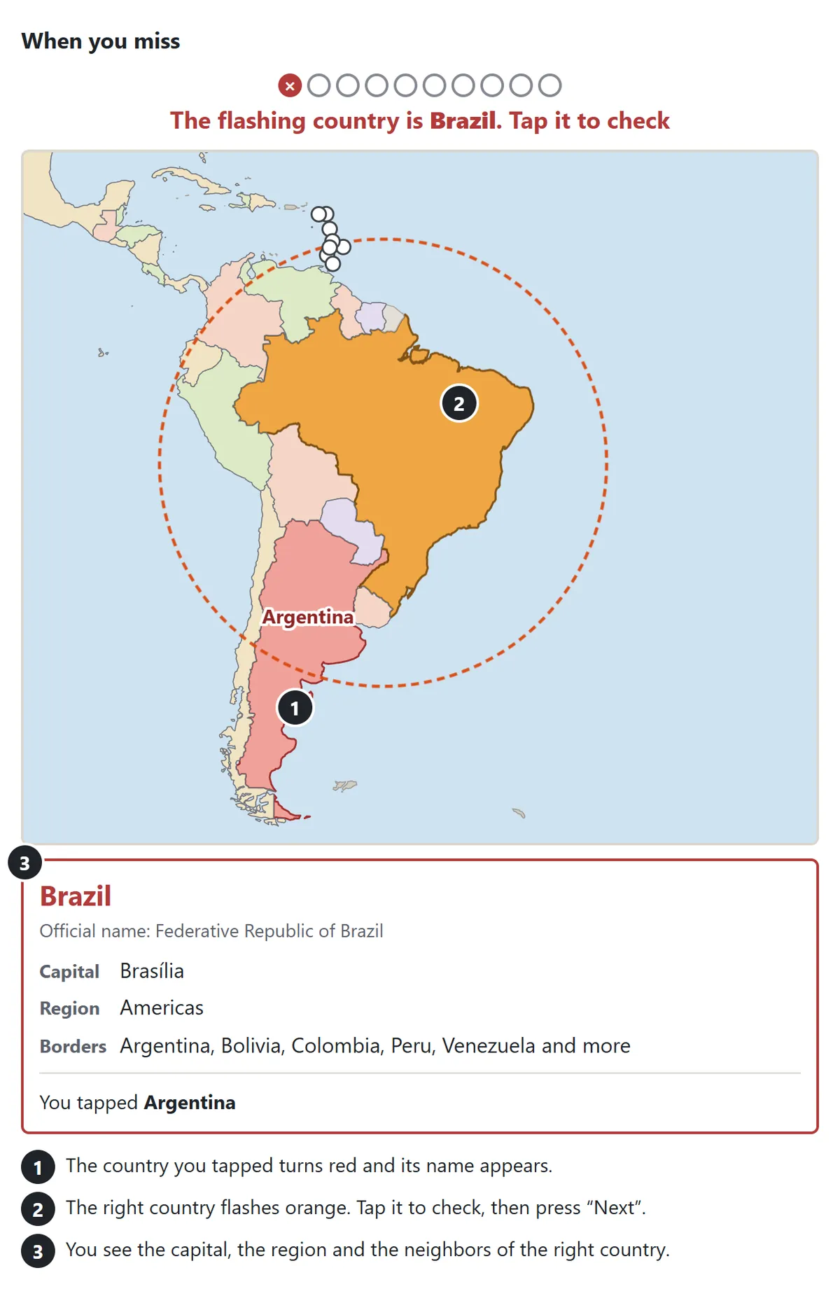
If you tap the wrong country, it turns red and its name appears on the map. The country you were looking for flashes orange. Tap it to confirm, then press Next. A short fact card opens at the same time with the country’s official name, its capital, its region and the countries it borders. It is worth a quick look: seeing your mistake and the right answer side by side is what makes the location stick the next time it comes up.
Name the highlighted country
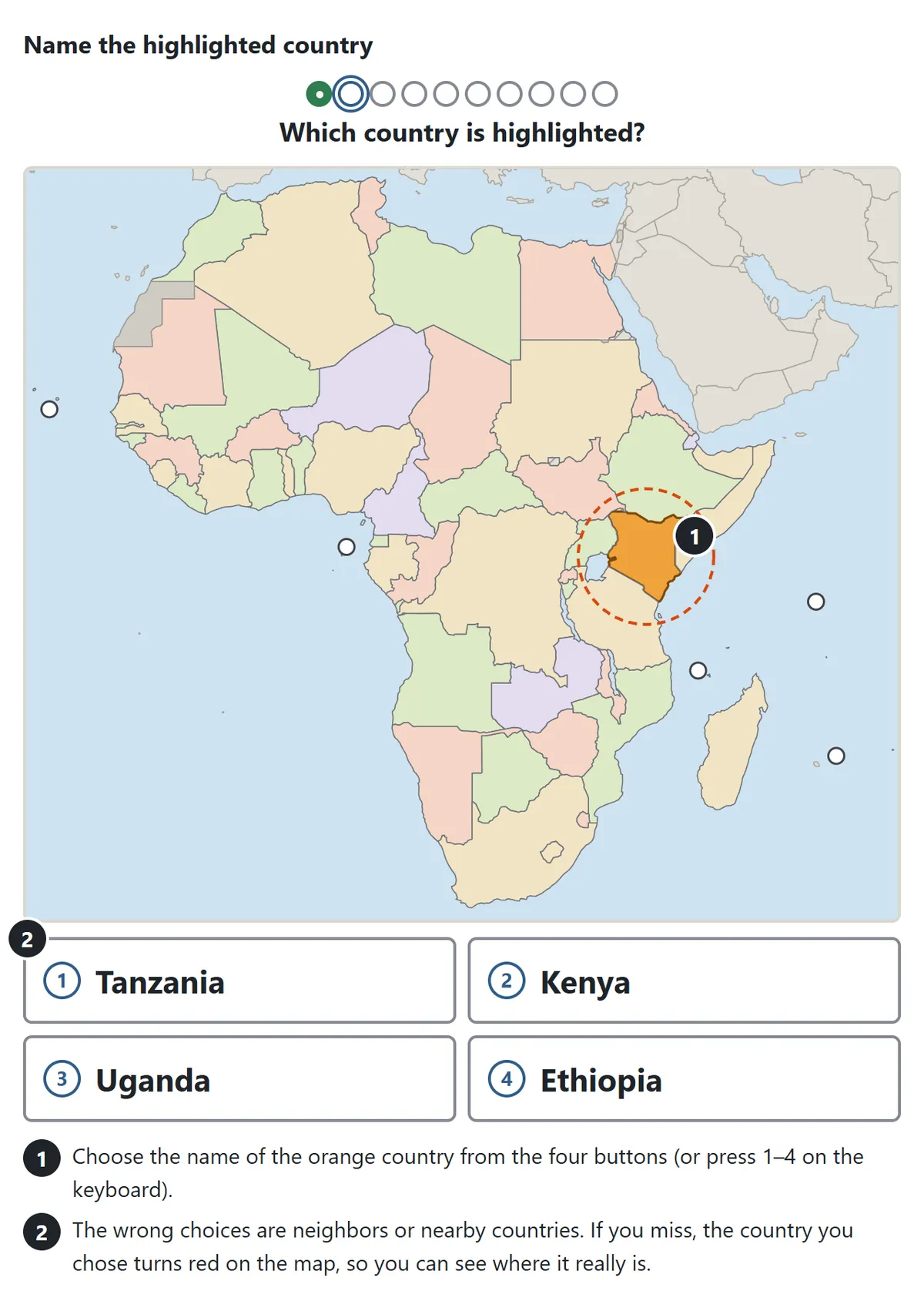
One country glows orange and you choose its name from four buttons; on a keyboard you can press 1 to 4. The wrong choices are neighbors or countries close by, so a rough guess like “somewhere in East Africa” is not enough. If you choose the wrong name, that country is painted red on the map, which shows you at a glance how far off you were. When the question is about a very small country, the map zooms in on its own.
World capitals quiz
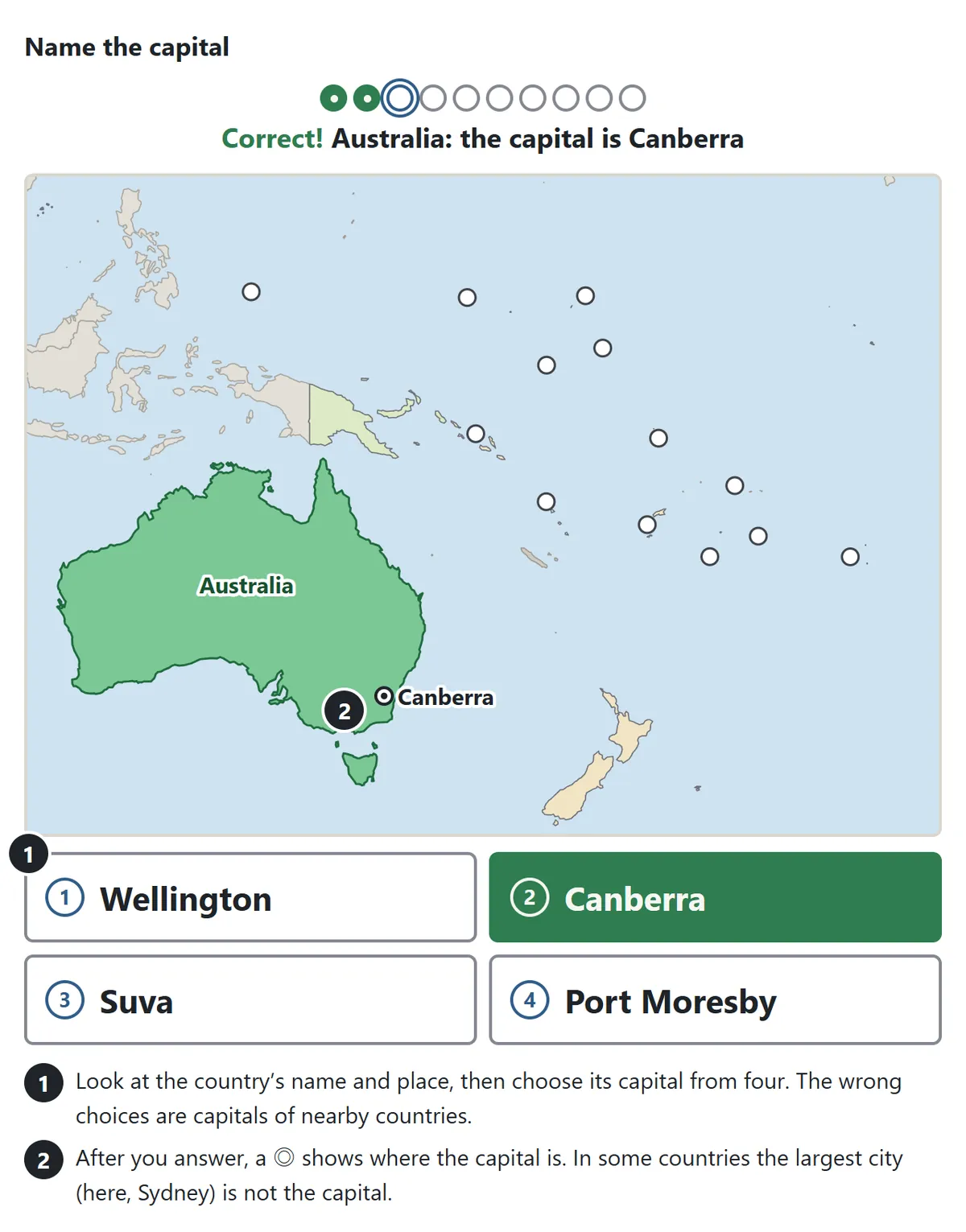
In the capitals questions you see the country’s name and where it is, and choose its capital. The other three choices are capitals of nearby countries. Once you answer, a double circle marks the city on the map. The classic traps are countries whose best-known city is not the capital: Australia (Canberra, not Sydney), Türkiye (Ankara, not Istanbul), Brazil (Brasília, not Rio de Janeiro), Canada (Ottawa, not Toronto) and Switzerland (Bern, not Zurich or Geneva). The map and name questions also show the capital whenever you get them right, so you pick up capitals even when you are not drilling them.
Zooming in on small countries
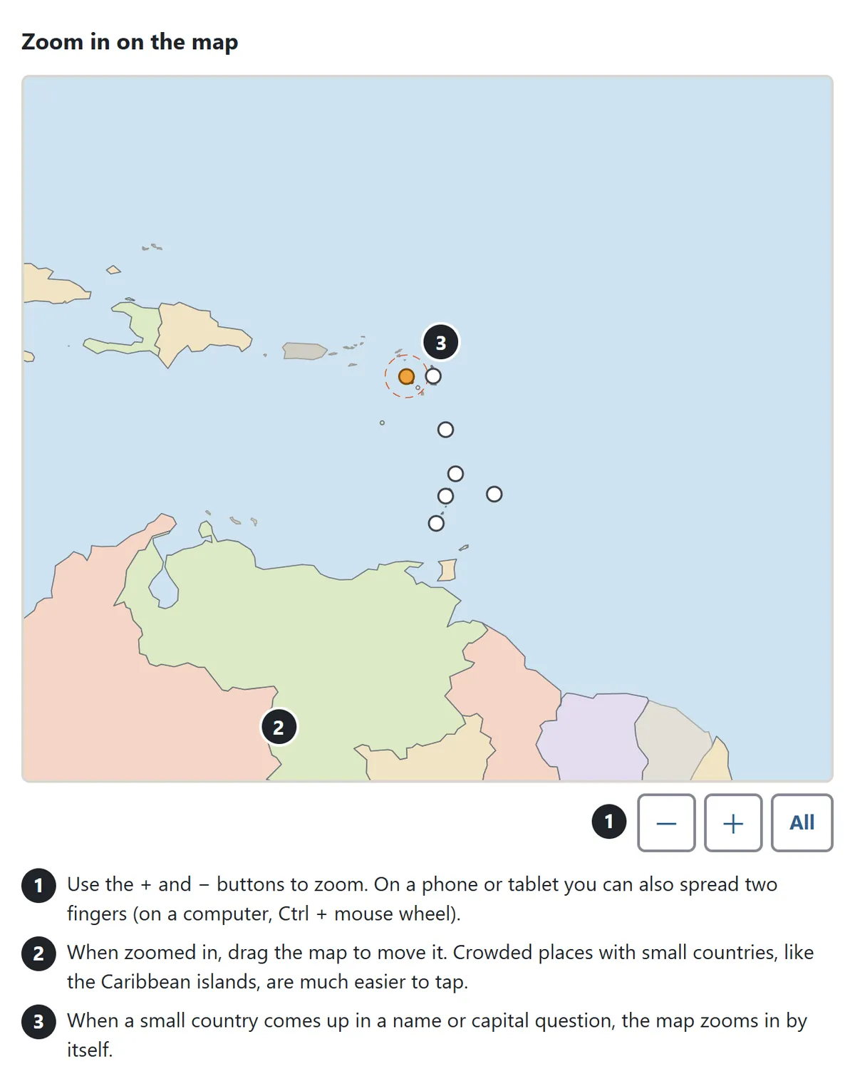
Use the + and − buttons under the map to change the size. On a phone or tablet you can also spread two fingers, and on a computer Ctrl plus the mouse wheel does the same. While zoomed in, drag the map to move around; lifting your finger after a drag is never taken as an answer. All takes you back to the full view. Zooming helps most in crowded places such as the Balkans, Central America, the Persian Gulf and the island chains of the Caribbean.
Game modes
| Mode | What you get | Record |
|---|---|---|
| Practice | Pick the question type, the region and 10, 20 or all of the countries in that region | Rounds played and perfect rounds, for each type and region |
| Daily 10 | Ten questions chosen by the date from the whole world: 4 map, 3 name and 3 capital questions. Everyone gets the same set that day | Days in a row |
| Weak countries | Up to 20 of the questions you have missed before | How many are left |
The regions are Asia, Europe, Africa, the Americas and Oceania, plus Well-known countries and Whole world. Well-known countries is a shorter list of the nations you hear about most often in the news and in international sports, and it is the best place to start. At the end of each round, the questions you missed and the ones where you used a hint come back once more, and the round ends when you get them all. The result screen paints that round’s countries on the map in green (right on the first try) and red (missed), and the settings panel keeps count of how many countries you have found on the map on your first try.
Map colors and disputed areas
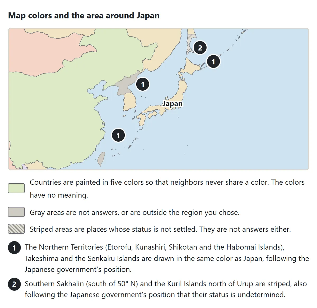
Countries are filled with five pastel colors chosen so that two neighbors never share the same one; the colors themselves mean nothing. Gray marks places that are not part of the quiz or lie outside the region you picked. Stripes mark land whose status is disputed or undetermined.
Borders on any world map reflect a point of view, and this site is run from Japan, so the map follows the Japanese government’s position. The Northern Territories, Takeshima and the Senkaku Islands are shown in Japan’s color, while southern Sakhalin and the Kuril Islands north of Urup are striped. Elsewhere, areas such as parts of Kashmir and the Golan Heights are also striped. None of these places is ever the answer to a question, and tapping them is neither right nor wrong.
Tips for learning the countries of the world
1. Start with the big countries, then spread out
In each region, first fix the positions of the giants – Russia, China, India, Brazil, Canada, Australia, Algeria, the DR Congo. They become landmarks, and every smaller country can then be described as “next to” one of them. The list of neighbors on the fact card after a miss is a ready-made list of what to learn next.
2. Use coastlines and peninsulas as anchors
Shapes are easier to remember than names. The Iberian Peninsula holds Spain and Portugal, Scandinavia holds Norway and Sweden, the Arabian Peninsula holds Saudi Arabia, Yemen, Oman and the Gulf states, and Indochina holds Vietnam, Laos, Cambodia, Thailand and Myanmar. Once you know which body of water a country touches, the rest is usually easy.
3. Learn the tiny countries in groups
Europe’s microstates are easiest as a set: Vatican City and San Marino sit inside Italy, Monaco is on the French Riviera, Andorra lies between France and Spain, and Liechtenstein is squeezed between Switzerland and Austria. The small Caribbean islands are similar – zoom in and learn them as a chain running from the Bahamas down to Trinidad and Tobago.
4. Tell look-alike names apart
Some names are almost the same: Guinea, Guinea-Bissau and Equatorial Guinea; the Republic of the Congo and the DR Congo; Niger and Nigeria; Austria and Australia; Slovakia and Slovenia; Dominica and the Dominican Republic. Look at them on the map side by side and settle on one difference for each pair, such as “Niger is the big one in the desert; Nigeria is on the coast.”
5. Place capitals on the map, not just in a list
Capitals are much easier to remember when you know where they are. After each answer, notice whether the city is on the coast or inland, in the middle of the country or near a border. Some countries built or moved their capitals on purpose: Brasília, Abuja (from Lagos), Islamabad, Canberra, Naypyidaw and Astana are all planned capitals.
6. Mix the Daily 10 with your weak list
Missed questions are saved as weak spots on your device and drop off after you answer them right on the first try twice in a row. A good routine is the Daily 10 every day for variety, plus a round of Weak countries now and then to clean up. A question where you opened the hint does not count as right on the first try.
Geography quiz FAQ
What does the hint show?
In map questions, the hint names one or two neighboring countries (or the nearest country, for islands) and draws a ring around the general area. The answer is inside the ring, but not necessarily in its center. In name and capital questions, the hint gives the first letter of the answer.
Why are some country names different from what I learned?
Country names follow the short English names used at the United Nations, with the everyday form where that is more familiar (Russia, Iran, South Korea, Vietnam). Some countries have recently asked to be called by a new English name: Türkiye (Turkey), Czechia (Czech Republic), Eswatini (Swaziland), Cabo Verde (Cape Verde), Timor-Leste (East Timor) and North Macedonia. Where an older name is still widely used, it is shown in small type next to the current one.
Can I play on a phone or a Chromebook?
Yes. The quiz works in the browser on phones, tablets and computers, including Chromebooks and iPads. On narrow screens the map is drawn a little taller, and you can pinch to zoom.
Where is my progress saved?
Your records and weak list are stored only in this browser on this device. There is no sign-up or login. If you leave in the middle of a round, open the page again on the same device and press Continue in the settings.
Is there sound?
Sound is off at first. Press Sound: off under the game to turn on short effects for right and wrong answers.
How world maps are drawn
A globe cannot be flattened onto a page without stretching something, so mapmakers choose a projection that keeps what matters most for the job – true areas, true shapes or true directions. This quiz uses the Miller projection, which tones down the growth of land near the poles compared with the familiar Mercator map, and it is centered on the Pacific Ocean, as world maps usually are in Japan. Even so, Russia, Canada and Greenland look larger than they really are, and Africa looks smaller.
Borders change too. After the Second World War dozens of countries in Asia and Africa became independent; around 1990 the Soviet Union and Yugoslavia broke up into many new states; and in 2011 South Sudan split from Sudan. Capitals move as well, and names change. A world map is a snapshot of the present, and the countries in this quiz will be updated as the world keeps changing.